Friday, December 01, 2006
From the logbook...Airstrip map
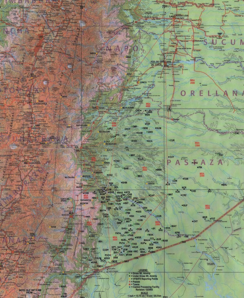
I know that when I write about where I went and what I did, it can be hard to visualize where I really was, and then where I went, etc. I scanned our airstrip map that we use. I don't claim it to be very good quality, but you can at least get a sense of what we do and where. This portion of the map is only the southeast corner of the country. You may be able to find Shell with the identifier of "SHL." All of the little black and green dots are our airstrips. We have over 200 of them and I have been into about 35 at this point. It will take me years until I have been in all the airstrips. I hope to figure out a way to put a better quality image on the blog when I have more time, and then link the airstrips that I am talking about for those of you who are like me and enjoy maps and finding places. If you click on the map, and then click it once more after that it will be a little better for viewing quality. Today my flight was very simple. I went from Shell, "SHL," to Conambo, "CON," and then back. See if you can find it. It is about 40 minutes to the east from Shell to Conambo. 
Subscribe to:
Post Comments (Atom)
No comments:
Post a Comment